| MSI PLANET Terrain Data UTM Projection
The index file defines the edges of the terrain database and specifies the cell size. One entry is provided for
each file. An example of a line in an index file is given below.
toluca1.hgt 384000 484050 2080200 2180250 50
This is interpreted as
file name tolucal.hgt
west edge 384000 meters
east edge 48450 meters
south edge 2080200 meters
north edge 2180250 meters
cell size 50 meters
The east and west edges are the UTM eastings
and the north and south edges are the UTM
northings.
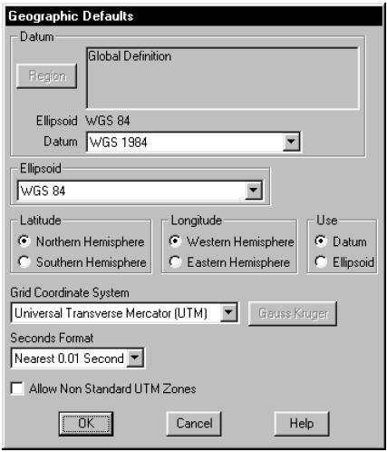
Geographic Defaults
The first step is to set the datum or ellipsoid to
correspond to the projection file. Select Configure - Geographic Defaults. Set the grid coordinate system (projection) to UTM.
Configuration
The Pathloss program uses a generic terrain database reader which was developed for the Logica Odyssey file format. The Planet height files can be read directly. No file conversions are necessary. The setup procedure is described below:
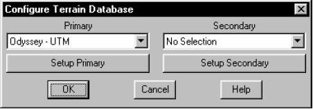
Select Configure - Terrain Database and
then select Odyssey UTM.
Click the Setup Primary button to configure
the terrain database.
Set directory
Click the Set Directory button and point to
the directory (folder) containing the Planet data files.
|